
The Ecuador Amazon: A Student Guide to Tena
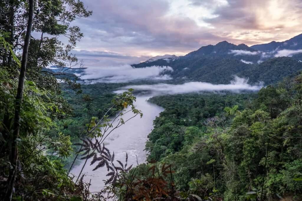
A few hours' drive east of Quito, the Andes drop away into dense green forest, wide rivers and towns surrounded by farmland and trees. This is the Ecuador Amazon, and Tena, the capital of Napo province, is one of its main gateways. For students interested in environmental engineering, sustainable building or community development, few places show the link between nature and infrastructure so clearly.
The region is beautiful, but it's also a place where heavy rain, humidity and distance shape how homes and services are built. In this article, you will learn what makes the Ecuador Amazon unique, what Tena is like as a place to live and work, how climate affects construction, and how students can prepare for a service learning trip in the region.
Understanding the Ecuador Amazon
Where the Andes meet the rainforest
Ecuador's Amazon region covers the eastern part of the country. Napo province lies within this region, with thick rainforest and rivers that feed into the Amazon basin. Much of that land is protected: according to the Napo provincial development plan, 71.10% of the province's territory falls under conservation categories, including six areas of Ecuador's National System of Protected Areas (SNAP).
Rivers that shape the land
Rivers define daily life here. They connect communities, feed the farmland along their banks and shape where roads and homes can be built. When heavy rain swells them, they are also a reminder of why drainage and building location matter so much in the region.
People and culture
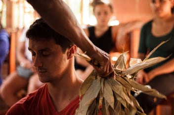
Napo is home to many Amazonian Kichwa communities. In Ecuador's 2010 census, 56.8% of the province's residents self-identified as Indigenous, according to INEC. Family farming systems called chakras combine food crops, trees and medicinal plants. The FAO recognized the Amazonian Chakra as a Globally Important Agricultural Heritage System in 2023.
Tena at a glance
Here is a quick snapshot of Tena and its surroundings:
| Feature | Detail |
|---|---|
| Region | Ecuador's Amazon region, east of the Andes |
| Province | Napo, with Tena as its capital |
| Climate | Warm and humid, with rain throughout the year |
| Rainfall | About 3,352 mm per year at INAMHI's Tena station (2019 data) |
| Protected land | 71.10% of Napo's territory under conservation categories |
| Communities | Many Amazonian Kichwa communities |
| Farming | Chakra agroforestry systems, recognized by the FAO in 2023 |
The rainfall figure comes from data by INAMHI, Ecuador's national weather service, as reported in Ecuador's national communication to the UN climate convention.
What the climate means for construction
Heavy rain and high humidity create very different design challenges from the dry hillsides of Lima or the cold highlands of Cusco. In a place like Tena, builders and engineers think carefully about:
- Moisture: protecting materials and structures from constant dampness
- Drainage: moving rainwater away from homes and paths
- Ventilation: keeping homes comfortable in heat and humidity
- Access: reaching communities spread out along rivers and roads
Local architects and engineers bring essential knowledge about which materials and methods hold up in these conditions. For students, seeing those decisions explained on site is one of the most valuable parts of working in the region.
Preparing for a service learning trip in Tena
Know the projects
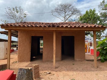
Safe Homes Movement, powered by MEDLIFE, works with families in the Tena area on projects such as home construction and other community infrastructure. Read what to expect in Ecuador and how volunteers support building hope in Tena.
Understand the housing context
Many families in Ecuador face barriers to safe, stable housing. Our article on housing challenges in Ecuador explains why.
Pack for rain and heat
Plan for warm, humid days and frequent rain. Light, quick-drying clothing, rain gear and sturdy closed-toe shoes make site work more comfortable. Bring a refillable water bottle and plan for time to adjust to the heat during your first days on site.
Respect communities and land
The forest, rivers and chakras are places of work and cultural meaning. Follow local guidance, ask before taking photos and listen to how residents describe their own needs.
Work as part of a team
On the development service learning trip, students work alongside residents and local professionals. Every project follows a 50/50 model: the community identifies the need and works on site, while local architects and engineers lead the design and supervise construction. Trips run in summer, winter and spring.
Discover the Ecuador Amazon from the ground up
The Ecuador Amazon is a powerful place to learn how climate, culture and infrastructure connect. If you want to see it firsthand while building alongside communities in Tena, fill out the form to get dates, eligibility details and next steps for the Development Service Learning Trip.
Frequently asked questions
Where is Tena in the Ecuador Amazon?
Tena is the capital of Napo province, in Ecuador's Amazon region east of the Andes. It's surrounded by rainforest, rivers and farmland, and many Amazonian Kichwa communities live in the province.
What is the weather like in Tena?
Tena is warm and humid, with rain throughout the year. INAMHI, Ecuador's weather service, recorded about 3,352 mm of annual rainfall at its Tena station, according to data reported in Ecuador's national communication to the UNFCCC.
Can students volunteer in the Ecuador Amazon?
Yes. Service learning programs such as Safe Homes Movement welcome high school and college students to work on community projects in Tena under the supervision of local professionals.